277 HITS ON THIS PAGE THIS YEAR           
 | | Notice Boards |
Now almost a suburb near the eastern extremity of Bournemouth, the village of Throop is a pretty mixture of the ancient and modern bordering on the banks of the river Stour and its main Road, Throop Road, is part of the Stour Valley Way.
|
The name is a variation of ' Thorpe ' -
its Danish origins reminding us of a time when the Norsemen invaded this part of England and
tarried a while before they were expelled by the Saxons of Wessex (the Danes landed at Dorchester
in 787AD).
|
Now Throop and adjacent Holdenhurst have become overshadowed by the
conurbation of Bournemouth
but at the time of the formation fo the Hampshire Constabulary in 1839,
Bournemouth was
described as a watering place policed by the village constable of
Holdenhurst. The first
constable (PC Smith) was appointed in 1856.
A mixture of old cottages and farms with much new development, at the southern end of the
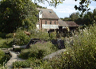
village stands Throop Mill which, although privately owned, is open
to the public three or so times during the year thanks to the Friends of Throop Mill. The village
once had a pub, The Jolly Sailor, as well.
Records of the establishment exist from 1805, the 1851 census and 1185. Robert Read, the
publican, and his wife were barred from attending church for blasphemy until they repented
and were allowed to return to the flock.
|
| | | Links to Other Pages on this Site
|
| |
| | |
|
| | | Links to Other Sites
|
| |
| | |
|
| | | Links to Other Pages on this Site
| | | | OTHER PLACES | | Silbury Hill
Wiltshire, England
The purpose of the
huge mound, a huge investment of prehistoric resources, can only be guessed
at | 72.7 km NW | | Lacock Fox Talbot Museum
Lacock nr Chippenham, Wiltshire SN15 2LG
A museum of photography comemmorating William Fox Talbot who was the inventor of the modern photographic negative. | 75.2 km NW | | Windmill Hill
Wiltshire, England
5,500-year-old Neolithic causewayed enclosure - one of the earliest
Neolithic settlements in England | 75.8 km NW | | Atwell-Wilson Motor Museum
Downside, Stockley Lane, Calne, Wiltshire SN11
Cars from 1924-83, classic motorbikes and memorabilia. | 76 km NW | |
Built around and Elizabethn House dating from 1582, by Capability Brown, John Nash and Thomas Bellamy, the house houses many art treasures by names such as Adams, Caravaggio, Chippendale, Lippi, Michelangelo, R | 78.6 km NW | | British Empire & Commonwealth Museum
Clock Tower Yard, Temple Meads, Bristol BS1 6QH
The British Empire & Commonwealth Museum represents the first serious attempt in the United kingdom to present a publicly accessible history of the British empire and to examine its continuing impact on Britain and the rest of the world. This was the larg | 93.3 km NW |
THROOP MILL
HOLDENHURST
THROOP, Dorset
|
| |
| | |
Recommend a Book for this Page
Hits on this page since December 6th| Jan | | |  | | Feb | | |  | | Mar | | |  | | Apr | | |  | | May | | |  | | Jun | | |  | | Jul | | |  | | Aug | | |  | | Sep | | |  | | Oct | | |  | | Nov | | | | | Dec | | |  |
current year:  | | previous year:  |
No messages posted on this page Only Members of the Site can post messages in this section. Signing in is easy from our Home Page. DISCLAIMER: Whilst we endeavour to ensure the content of this site is correct, we cannot undertake that information you find here, is, or will remain accurate and complete. We do not warrant that any information contained on this site is fit for any purpose. If you wish to place reliance on any such information you must check its accuracy by some other means before doing so. MEMBERS get aditional features on our pages and will soon be able to interact with the site and add their views and informastion. Sign up, from the Home-Page, is simple and involves typing in your email address and a password of your choice. If you are in any way connected with any location or interested in the subject mentioned on this page and have an hour or two a month to spare, we would welcome you as a local moderator - please email the webmaster by CLICKING HERE. Privacy Policy
|
|


